UPDATE: As of June 2015 the track has had a major clean up with much of the wind fall cleared, which will make the track more rideable with less carrying than what we encountered in February 2015 below. The new DOC link is here. More details on the improvements can be found here.
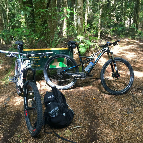
We just completed the full Te Iringa trail with overnight camping and thought we’d share our experience to provide you with more information on what to expect, and share some tips on how to make the ride better and safer. We bumped into a mate hunting early on the track who knows the area well and he gave us some advice and also chatted to a DOC Ranger mid trail who is also a mountain biker who also helped us.
Te Iringa is an out and back trail in located in the Kaimanawa Forest off the Napier-Taupo Road so it’s close for Hawke’s Bay residents and those in the Central North Island. The 19km trail follows an old Maori route through the forest.
There are some great informational websites on riding the full trail with the official DOC information, NZ by Bike and Great Lake Taupo (links below) but most articles with more descriptive content only cover the day trip option to the half way point eg. the recent article on Pinkbike and the article by Paul Smith on Licence To Ride (links below). The official info probably doesn’t quite convey how many obstacles there are at present, even on the flat sections with huge tree windfall, deep bogs, blown out creeks, slips, deep & narrow channels.
The big variable in how difficult the trail is (other that the weather) is whether you are riding a day trip or overnight in that the amount of weight you will be carrying will be significantly more if you choose the two day option. Staying in the hut will mean taking less than camping but if you want to be self-sufficient then make sure you have light weight gear and understand that carrying that weight on your bike or back will take its toll especially with all of the scrambling over trees and that it will change the way your bike handles and your ability to climb and change direction quickly. Staying overnight might mean more weight but if you want to truly experience this magical forest and have the gear and time then we thoroughly recommend doing it.
Before wondering if it’s all worth it then YES IT IS. Two amazing descents and plenty of flowing trials in between obstacles make all the tough bits worth it. The hero dirt covered in beech leaf fall is heavenly to ride, and the forest and streams are beautiful. The remoteness, isolation and the fact we only saw 2 people, one of which we knew make the whole experience even better. The birdlife is prolific and we spotted rare Blue Ducks (Whio), North Island Robin, Fantail, Tomtits, Morepork etc.
We’ll break it down by sections for the ride in with notes on riding the same section back out:

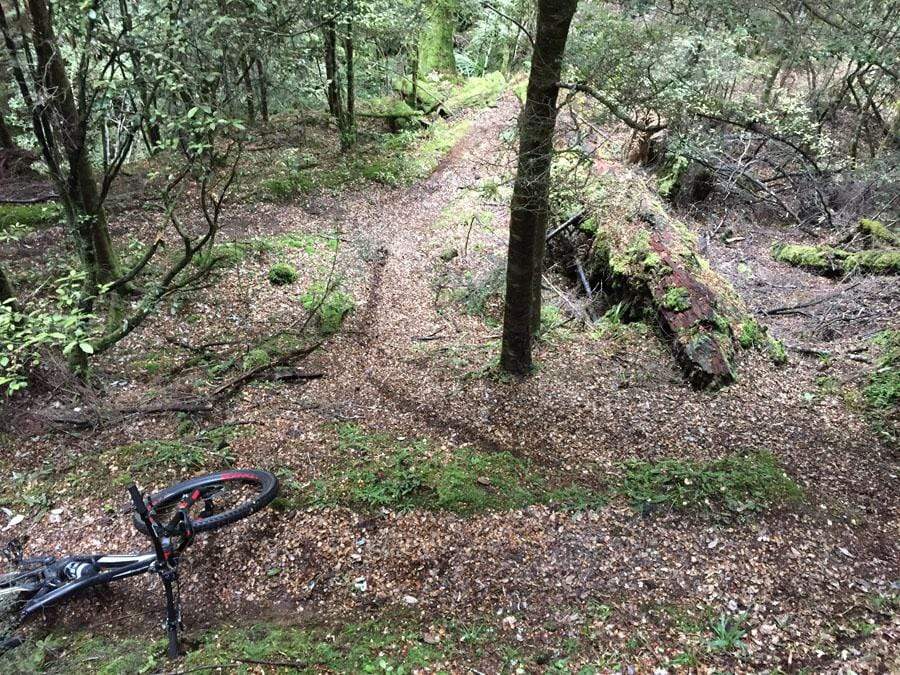
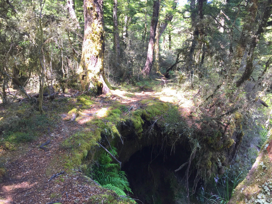
Clements Mill Road Carpark to Old Te Iringa Hut: Tough climb to a clearing where the old Te Iringa Hut used to be. Lots of channels and steps, drops that are unridable up but become great lines on the way down (see pic below). A fun 15-30 minute technical descent – you’ll be buzzing at the bottom.


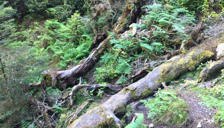
Traverse around Mt Te Iringa: Very arduous section both ways with the trail traversing around Mt Te Iringa, clinging to the side. Views of Ruapehu, Mt Ngauruhoe, Lake Taupo out to the West and over bush clad Kaimanawas and farmland to the North East. Steep drops to the side, huge trees to climb over, walk along and under, slips carry your bike around. Very interrupted riding which can be frustrating if you remount only to find you have to dismount around the next corner.

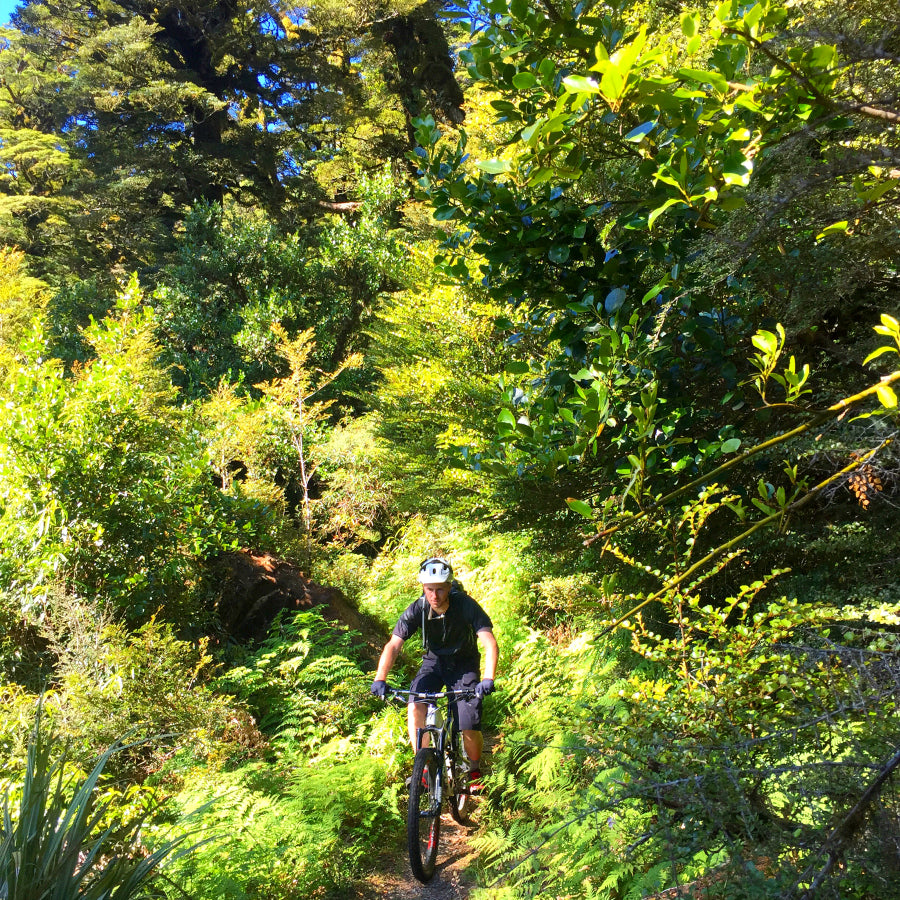
Descent to Tikitiki Stream/Kaipō River Junction: After the traverse and its interruptions the trail forms a beautiful fast flowing singletrack covered in Beech leaves. An amazing native singletrack experience with great flow. Tough climb on the way back up especially if carrying equipment. Mostly rideable but expect a high heart rate if riding.


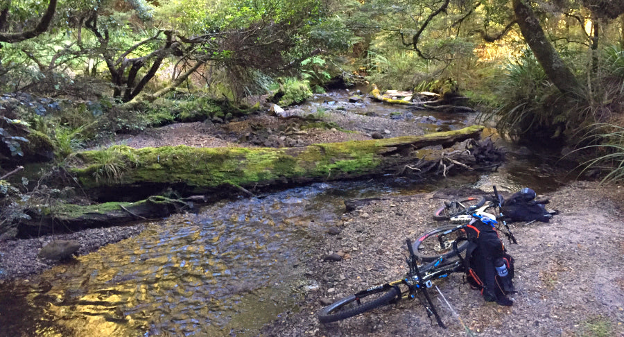
Tikitiki Stream Crossing at Junction: After the staircase down you’ll hit a camping area on the Tikitiki Stream. There are quite a few trails going off in all directions and it’s hard to see which one to take. Just downstream the Tikitiki meets the Kaipo and you can see the junction through the trees. The trial goes up a steep bank on the other side of the Tikitiki with a rope that’s hard to see but if you cross over the logs that completely cover the stream you’ll the bank to scramble up. There are several logs lying just downstream as well but they lead to nowhere.


Tikitiki/Kaipo junction to Swingbridge on Kaipo River: Undulating with the usual trees down and washouts. Several bogs to cross. Similar in reverse.


Swingbrige to Oamaru Hut: Undulating singletrack that follows the Kaipo River with great camping along the river. Bogs, fallen trees, trail washout and very overgrown at present. The trail through some sections of mossy bog are undistinguishable so keep an eye out for tree markers to spot your entry back onto the trail. Similar in reverse.


TRAIL DANGERS
Weeds: Bush Lawyer hanging over the trail will tear your arms, legs and face as you ride past at speed and Hook Grass (Sedge) grabs at any hairy legs and will cling on.
Branches/Roots: There are loads of sharpened branches sticking out from the side of the trail many of which are leg height which would be a nightmare if they connect with your legs. There are also many pointy roots sticking up from the trail ready to tear sidewalls.
Overgrown Trails: Some sections particularly on the second flatter half of the trail had very limited or no visibility of the trail. Your ability to read the trail and concentrate is paramount as is anticipating the worst beneath the overgrown brush. At one point Tony shot over a 1 metre drop hidden behind small bushes covering the oncoming trail. The trail had been completely washed away.
TIPS
Weather: Ride it in good weather. Doing it in wet conditions will make it way harder, particularly all of the climbing over fallen trees.
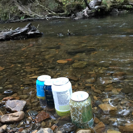
Camping: If you are willing to carry a tent then there are many beautiful spots to camp along the Kaipo River, both on beaches and flat sections of the riverbank. You could also camp on the grassland near the Oamaru hut but the forest if far more appealing and sheltered.
Day Tripping: If you prefer day trip then you can either go to the top of the first climb (4km) to get the awesome technical descent back down or go on further past the tough traverse to hit the flowing Beech Forest decent down to the Tikitiki Stream (11km). Bare in mind this means you also need to climb back up that decent and go back through the arduous traverse for the second time in a day. Plenty of people do this complete day trip and that way you get the two great downhill sections of the trail.
Fishing: There is superb fishing in the streams nearby. The Kaipo and Oamaru streams meet to form the mighty Mohaka.
Spare Equipment: We carried a selection of spare parts, emergency spares and tools, because you can't just ring your mate to come and collect you if something goes wrong – you are on your own! Check your bike before you go, especially brake pads, tyres and chain. This is what we carried: Spare tyre, tubes, tyre boot, tyre levers, glueless patches, pump, CO2, chain, chain links, chain lubricant, derailleur hanger, electrical ties, and a selection of allen keys, torx keys, multi tool, leatherman. If you are travelling as a group items can be spread across the group to lighten the load and most of our bits were carried in large seat bags.
VITAL INFORMATION
Topo Map: BH37
Grade 5: Technically challenging. Giant climbs, narrow track and numerous hazards including dangerous drop-offs, sharp corners and difficult obstacles. Expect walking and possibly bike carrying.
Access: Clements Mill Road access: 27 km east of Taupō. From Napier turn left off State Highway 5 (Napier-Taupō Road) into Taharua Road. After 9.5 km turn right onto Clements Mill Road and the carpark is 5km down the road on the left after a bridge.
LINKS
http://www.greatlaketaupo.com/things-to-do/biking/trails/te-iringa/
http://nzbybike.com/regions/lake-taupo/regional-mountain-bike-rides/te-iringa/
http://www.licencetoride.co.nz/trails/taupo-mtb-trails/four-days-to-taste-taupo/
http://www.pinkbike.com/news/te-iringa-out-and-back-in-new-zealand-natives.html
PHOTOS


For more info pop into our shop and have a chat !